On February 6th, this Pacific storm brought another cold front to Hawaii:

 The surface low was at 976 mb as far south as 36N latitude:
 On February 8th, a storm near the southern tip of Greenland dropped to 948 mb:
 A second storm to the southwest at 957 mb, is now (as of 18Z) at 950 mb just southeast of where the first storm had been.
Another major winter storm hit the south yesterday (February 9th), prompting winter storm warnings (pink) from Texas and Oklahoma to Alabama, and more hard freeze warnings (dark blue) for the Gulf Coast:
 Snowfall amounts were up to 25" in Oklahoma (Jay), and 24.5" in Arkansas. The 5.7" at Tulsa, OK pushed the seasonal total to 26.1", making this their snowiest winter on record (old record 25.6" in 1923/24).
Numerous new record low temperatures were set across Oklahoma on the 10th including 10 new all-time record lows (only 9 are shown), and even a new state record (-31 at Nowata):
 This storm also left 64.9% of the Contiguous US snow covered:
 A major pattern change will occur next week, bringing much warmer air to the eastern US. This is likely related to the fact that the arctic oscillation recently went positive for the first time since mid November:
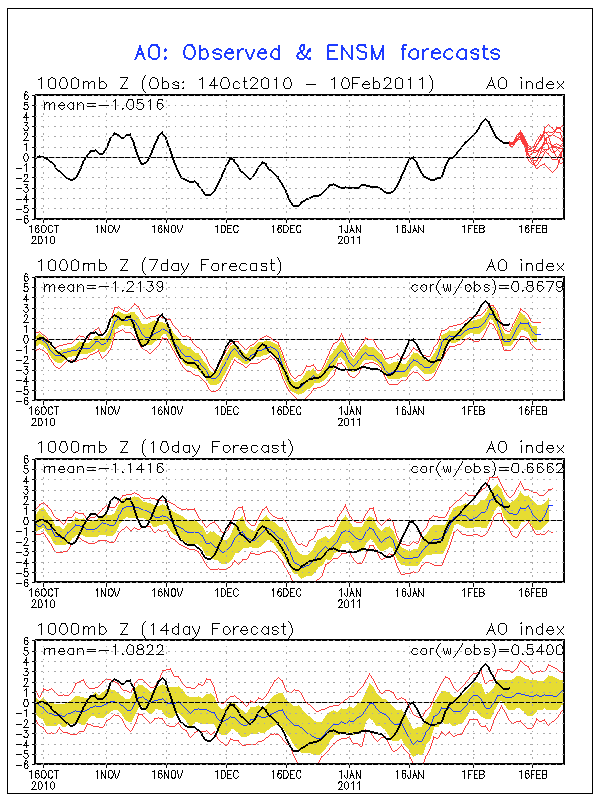
No comments:
Post a Comment