Oct 31, 2009

Record October Snow At North Platte

North Platte, Nebraska had already broken their October snowfall record before the same storm that hit Colorado put down another 13.5 inches ending yesterday. The monthly total of 31.5 inches is double the old record of 15.7 set in 1969. In addition, October's snowfall already exceeds North Platte's average seasonal snowfall of 29.8 inches!

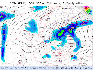
The storm that put down all that snow is still deepening over Hudson Bay with a minimum pressure of 956 mb and a cold front to southern Mexico.
That front produced a 7 degree temperature drop, winds gusting to 38.9 knots, and waves to 15.7 feet at buoy 42055 in The Bay Of Campeche.

Oct 29, 2009

Colorado Blizzard

A snowstorm in Colorado has already dumped over two feet of snow in central of Colorado today, including the Denver - Boulder - Fort Collins area, and it's still coming down. Over 40 inches accumulated in the higher elevations. Blizzard warnings (red) are currently in effect for northeast Colorado including Limon and Sterling. Winter storm warnings are in pink, winter weather advisories are in purple, and freeze warnings are in light blue. Severe weather watches (yellow) are in effect for the lower Mississippi valley, while various flood advisories extend into Missouri Iowa and Illinois.

As of yesterday, Cheyenne, Wyoming had two feet of snow for the month of October, breaking a record set in 1906. North Platte broke their October snowfall record a week ago with 18 inches.

Freeze warnings are in effect for El Paso and Midland in Texas, and Tucson, Arizona, where the average first freeze is November 24th.

Brutal winter weather has also been affecting Europe. The blizzard that I mentioned as being on GFS charts at the end of this post on October 12th, hit Poland very hard and prompted the deployment of troops after 700,000 people lost power.

Oct 19, 2009

Frost/Freeze Update

Freeze advisories (light blue) have been extended through West Virginia, Kentucky, Tennessee, northern Georgia, Northern Alabama, and eastern Mississippi. Frost advisories are in effect for most of the Mid-Atlantic states, a large part of Georgia including Atlanta and Macon, and most of the remainder of Alabama even down to Mobile, where the average freeze date is Nov. 29th.

Oct 18, 2009

Hurricane Rick And Cold In The Southeast

Hurricane Rick in the Eastern Pacific is now a category 5 monster. The estimated minimum central pressure is 906 mb (26.75 inches)...maximum sustained winds estimated at 180 mph...with hurricane force winds extending out to 45 miles from the center and tropical storm force to 155 miles. Rick is the second strongest hurricane on record in the Eastern Pacific. A wider view:And a visible image from earlier today:Although Rick currently moving westward, a trough is forecast to dig into Southern California by Monday and turn Rick to the north. GFS has been consistent with moving Rick into Southern Baja by late Wednesday and NHC concurs:Meanwhile, a polar airmass with dewpoints in the 30s had prompted frost advisories (in blue) and freeze warnings (light blue) across the Ohio Valley and Southeast.Freeze warnings cover almost all of Ohio, most of Missouri, The Appalachians down to extreme Northeast Georgia, and even the County north of Tulsa, Ok. Frost advisories are in effect for most of Illinois, Indiana, Missouri, Kentucky, and Tennessee including Nashville and Chattanooga. Freeze watches (dark blue) go down to parts of Mississippi, Alabama including Birmingham, and Georgia including Atlanta and even to just two counties north of Macon. Dewpoints are now in the 30s even on the Gulf Coast.At station 42363, about 100 miles south of New Orleans, the dewpoint fell to 42.1. I am reminded now that this same station measured a dewpoint of 55F (12.8)C back on August 23rd. It should be noted that this is a drilling platform with measurements taken at a height of 37 meters as opposed to the more standard 4. Even so, the dewpoint at 4 meters at station 42039 115 nautical miles southeast of Pensacola was 57 0n August 23rd and 47.7 at 1AM today - and an air temperature of only 60.4 currently. This cool airmass has swept through the entire Gulf of Mexico.Buoy 42055 in the Bay of Campeche recorded a temperature drop of almost 7 degrees.Even though this buoy is at 22 latitude, the front was still strong enough to produce 35 knot wind gusts and sustained winds at over 3Also, Eureka, Canada on Ellsemere Island already hit -20 degrees on Oct. 17th. It went down to -22 at 8PM with a dewpoint of -31.

And yes, there was even more snow in central Pennsylvania...

Oct 17, 2009

Record Early Snow In Pennsylvania

As much as 9 inches of heavy, wet snow fell in central Pennsylvania on Thursday and Friday (OCT 15-16), with 4.7 inches at State College. Large tree limbs and power lines are down across northern Pennsylvania including in State College. This is typical with such a heavy snow this early in the season because the snow more easily sticks to the branches which still have their leaves. For many areas, this was the earliest measurable snowfall on record. See more here.

Snow also accumulated in New York State and even parts of Massachusetts and Connecticut.

Oct 15, 2009

North Atlantic Storm


A storm off the coast of Newfoundland just had an an incredible pressure drop of 27 mb (0.79 inches) in 12 hours and an almost unbelievable 49 mb (1.44 inches) drop in 24 hours. It is now at 953 mb (28.14 inches) - lower than any Atlantic tropical cyclone this year except Hurricane Bill.
Category 3 Hurricane Fred - the only other Atlantic hurricane this year - had an estimated minimum central pressure of 958 mb. Despite the sparsity of buoys in the North Atlantic, 24.6 foot waves (station 44138) and 62.2 knot wind gusts (station 44139) have been measured - and that was just before the 27 mb pressure drop! Those measurements were taken when the storm was south of Newfoundland - where buoy data is available - not east of Newfoundland where it became a 953 mb storm and there are no buoys. Satellite scatterometer data shows winds at 50 knots in several locations between areas of possible rain contamination (indicated by black wind barbs).

Oct 14, 2009

California Gets First Major Storm

A storm at 967 mb hit the west coast yesterday with high winds and flooding rains.Buoys as far south as 36.789 latitude - south of San Francisco - (buoy 46042, 42.7 knots) have recorded gusts over 40 knots. The highest wind gust that I found was buoy 46014 with 44.7 knots at 39.196 latitude. Over land however, a wind gust of 72 mph was reported at Pike County Lookout - north of Sacramento and almost exactly straight east of buoy 46014 - at an elevation of only 3714 feet. Flood advisories have been issued as far south as Los Angeles.

Oct 12, 2009

Early Midwest Freeze And Clouds

Most of the Midwest has already had a freeze, and about two-thirds has hit 28 degrees or colder.Freezes are being reported about 200 miles beyond the median freeze line for Oct 12.
To put it another way, the median freeze line is actually close to the 28 degree line. This would suggest that lows are about 4 degrees colder than normal along that line, which is true - but the highs have been 8-18 degrees below normal in those same areas.
The reason highs are affected more is that clouds accompany such a strong cold airmass. In fact, most of the entire country was cloudy today.It has been suggested that increases in cloud cover amplify the cooling effect of a decrease in solar activity by reflecting radiation away. This certainly seems plausible given how cold and cloudy it has been, and given the fact that the sun has been very quiet for over two years now.

Europe is also having unusual cold and snow with Austria having its earliest snow ever.
And Poland, The Czech Republic and Slovakia might see blizzard conditions by Wednesday morning.

Oct 10, 2009

Updated Frost/Freeze Map and Nebraska Snow

Freeze warnings now extend to Springfield and Quincy in Illinois, Jefferson City (not shown, underneath flood warning) and Kansas City in Missouri, Medicine Lodge in Kansas, Woodward in Oklahoma, and the Texas panhandle, where record cold is expected. The southeastern Texas panhandle has normal freeze dates going into November. A frost advisory is in effect for Indianapolis.

Up to 17 inches of snow fell in Nebraska today and yesterday including a record 13.8 inches at the National Weather Service Office at North Platte Regional Airport. The old record of 13.0 inches, was set back in 1896. Over 7 inches fell in the Omaha area.

The storm in The Gulf of Alaska now stands at 962 mb (28.41 inches).
Buoy 46078 in the Gulf of Alaska recorded a 48.6 knot wind gust last night.

Oct 9, 2009

Early Signs of Winter


A Gulf of Alaska storm with hurricane force winds has reached 964 mb (28.47 in).
Buoy 46066, 380 nautical miles southwest of Kodiak, recently reported 28.9 foot waves with winds gusting to 46.6 knots.

Freeze (light blue) warnings have already been issued as far south Illinois, Missouri, Kansas and the Texas and Oklahoma panhandles.Frost advisories (darker blue band immediately below freeze warnings) extend even further south and now include Peoria and Quincy in Illinois, Kansas City in Missouri, and Hutchinson, Dodge City and Garden City in Kansas. According to the Farmer's Almanac, the average frost date for Chicago is Oct. 24, for Quincy is Oct. 22 and for Kansas City is Oct. 28. Freeze watches include Amarillo, Tx and Woodward, Ok. The light blue in Arkansas is for flood advisories (not freeze warnings).

Just south of Hudson Bay is a 210 knot jet streak - something that would be noteworthy even in January.
Snow is quickly piling up in the Northern Rockies.
Idaho, Wyoming and Montana had a heavy snow on September 30th and again on October 4th and 5th. Colorado actually saw snow in the high elevations on September 21st.

Light snow fell today in North and South Dakota, Nebraska, Minnesota, and Iowa.

And record cold is expected - even below zero - in Montana.

Oct 5, 2009

Non - Tropical Storm Grace

Last night, a very small area of convection in the northeast Atlantic was named Tropical Storm Grace. In this visible satellite image from early this morning, it is about halfway between the Azores and the English Channel.It is not much bigger than New Jersey. Over the last several years, NHC has been increasingly naming everything in sight. This particular example goes a long way toward showing this trend. Water vapor imagery shows the original disturbance rotating around the back(west) side of a large mid/upper trough stalled out over the Azores:

It was named a tropical storm at 3Z and at 41.2 N lat, 20.3 W lon over 70 degree F (21 C) waters.Over such cool waters, deep convection can only be supported by the steep lapse rate environment provided by the mid-level trough.A moist adiabat from 21 C at sea level will only reach around -8 C at 500 mb. If that parcel were placed in the tropics, where 500 mb temps are seen to be about -5 C, this would be likley produce a positive lifted index.Another non-tropical feature is the horizontal thermal contrast - although given Grace's small size it might be argued that the storm itself doesn't even cross more than one isotherm.
In addition, the best low-level moisture is displaced well to the southeast of the low pressure center - just like almost any typical mid-latitude system.
This is especially obvious at 850:Even with systems like this being named, tropical activity in the Atlantic should be below normal this year.