This MCS developed in northern Illinois late last night (June 25th), and produced flooding across the north suburbs of Chicago:
A CoCoRaHS station at Cary reported 6.15" at 7 AM on the 26th.
The COD storm chasers were frustrated yesterday when nothing developed in Iowa. Despite convective inhibition of only 3 on the 0Z Omaha sounding, convective initiation never occurred:
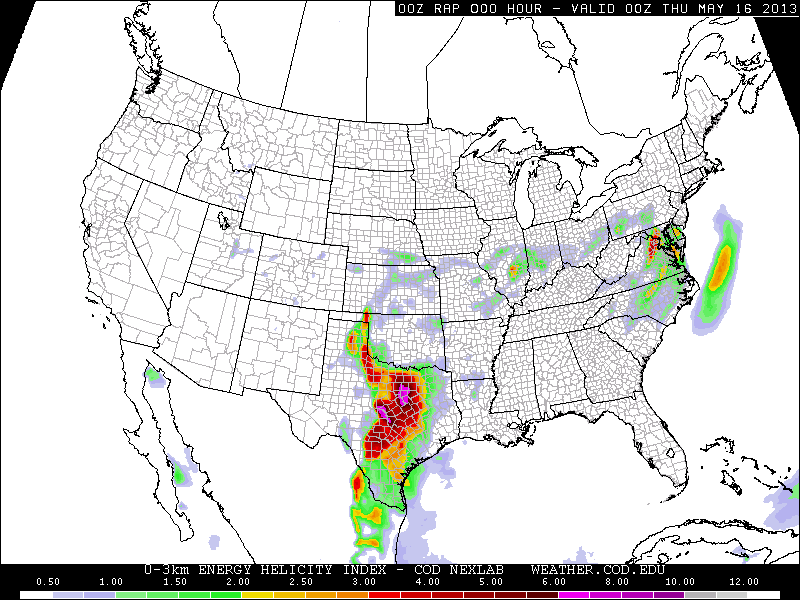
On May 15th, 18 tornadoes touched down across the Dallas-Fort Worth metro including an EF-4 which struck Granbury, killing 6 and injuring dozens. The 500 mb chart for this event was not very impressive with a speed maximum of only 30 knots. However, the southwesterly 30 knot flow at 850 mb combined with surface winds backed to southeasterly produced storm relative helicities (SRH) of 450 0-3 km and 200+ 0-1 km:
On May 19th, 6 tornadoes occurred in central Oklahoma including the EF-4 Shawnee tornado which killed 2. A radar loop is here. Video here and here. A tornado near Clearwater, Kansas was given an EF-2 rating based on radar data from the Doppler on Wheels. The Shawnee tornado was no surprise given a 60 knot southwesterly 500 mb jet, 35-40 knot southerly 850 low-level jet, and locally backed winds near Oklahoma City producing a 0-3 km SRH of 450 and 0-1 km SRH of 300. Note the small bullseye of 10 (top of the scale) in the significant tornado parameter (last chart below) over Oklahoma City.
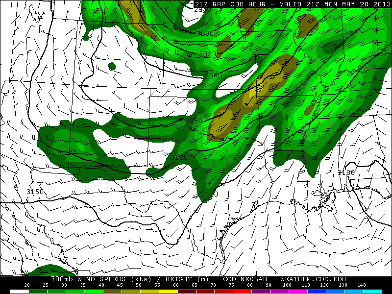
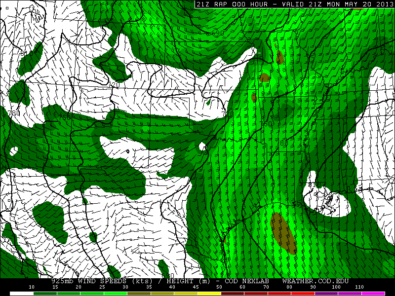
The next day, May 20th, another mid-level speed max ejected into the Southern Plains and produced the 1.3 mile wide EF-5 Moore tornado which killed 24, injured 377, and damaged or destroyed over 12,000 homes. A radar loop showing debris ball and intense rotational couplet is here and a radar timeline here. See incredible video here, here, here, here, initial touchdown here, and helicopter time lapse here. What surprised me about the Moore tornado is that although the 500 mb speed was 60 knots, and the 700 mb speed was 45 knots, 850 winds were only 25 knots, producing 0-3 km and 0-1 SRH values of just 300 and 150 respectively. Similar to the Shawnee tornado, surface winds were backed only very locally near Oklahoma City, producing a very small bullseye in the significant tornado parameter:
Preliminary damage path for the Moore tornado:
On May 31st, EF-3 tornadoes developed at El Reno, OK and the St. Louis metro. The El Reno tornado killed 13, and hit several storm chase teams, including Tim Samaras, Paul Samaras and Carl Young, all of whom were killed. Video of amazing multiple vortex structure here, and here. See the Weather Channel's Mike Bettes being hit by the tornado here, and here, and other chasers being hit here, and here. Radar loops and photos of the El Reno tornado here. For the El Reno tornado, RAP analysis indicates 500 mb winds west-southwest at 50 knots, 700 mb winds southwest at 40 knots, 850 winds south at 30 knots, and southeast surface winds producing, SRH around 300 0-3km and 150 0-1 km. The Oklahoma City radiosonde observation shows a slightly stronger and much more veered flow immediately above 850 mb, and a 0-3 km SRH of 476:
I have a number of storm chasing videos on my Youtube channel from last month. This one is probably the most interesting:
Some have speculated that these tornadoes may be linked to global warming. Is is too easy to forget that the 12-month period before the May spike in tornadoes was at a record low:
If deadly tornadoes are evidence of global warming, what does a record quiet period indicate?
I am a self taught meteorologist and storm chaser. Much of my original interest came from Joe D'Aleo. I was later interested in the work of Theodor Landscheidt. My views on politics and economics are very close to those of Walter E Williams.