 On April 3rd, this huge 986 mb storm produced a significant severe thunderstorm outbreak from Kansas to Wisconsin.
 The next day, it produced a squall line which stretched from the Ohio Valley to the Gulf Coast:
 The Storm Prediction Center received an incredible 1318 wind reports:
 CAPE values through much of the Southeast were not very impressive.
 Notice however, that in some areas just ahead of the squall line, dewpoint depressions were higher than 30F:
 The next night, frost advisoties (blue) were issued from Alabama to North Carolina:
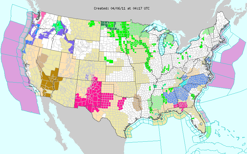 On April 6th, this storm in the Bering Sea dropped from 946mb to 936 mb in six hours:
 Buoy 46073 was hit with 41.3 foot waves on April 7th before it stopped transmitting. No data has been received from this buoy since.
 On April 9th, a tornado outbreak hit northwest Iowa including 4 EF-3s. The town of Mapleton was hit hard by an EF-3 tornado produced by this supercell:
 I was storm chasing that night, and was able to see several tornadoes including this one north of Odebolt, Iowa at 8:44PM CDT :
 This tornado was seen a few miles east of Newell at 9:52PM CDT, and was probably the one which later may have been 2-3 miles wide:
 The same storm which produced these tornadoes also dumped 14.1" of snow on Flagstaff, AZ
More tornadoes occurred on April 10th especially in Wisconsin, as the storm dropped to 986 mb in northeast Minnesota:
 Today, April 14th, a 993 mb storm in Kansas is producing another tornado outbreak.
 The same system is causing a blizzard (blizzard warnings in red, winter storm warnings in pink) in western Nebraska and northwest Kansas:
 At 10:00PM CDT, Goodland Kansas was reporting heavy snow, winds north at 46 mph, gusting, to 55, and 1/4 mile visibility. A wind gust of 58 was reported at 11:00PM. Widespread power outages have occurred in Hayes and Chase Counties in southwest Nebraska.