Oct 31, 2010

Tropical Storm Shary and Midwest Storm

On October 28th, at 9PM, (3Z, 29th) this area of convection just south of Bermuda was named Tropical Storm Shary.
It was in a strongly sheared environment on the northeast edge of a large closed upper low. Upper level winds were strong enough to push clouds to the Bahamas:
The large tropical wave which later became Tomas can be seen east of the Lesser Antilles and Venezuela. GFS analysis shows that the area in which Shary is located had 250 mb wind speeds in the 30-40 knot range:
The surface low is well southeast of the convection, and the strongest winds are due to a tight pressure gradient with the subtropical ridge to the north:
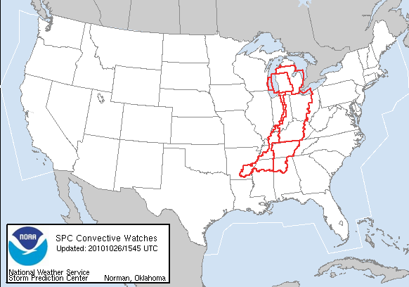
The 955.2 mb Midwest storm from October 26th was not the record for the lowest pressure in a non-tropical storm in the Continental U.S. A reading of 955.0 was confirmed at Block Island, RI on March 7th, 1932 and at Canton, NY on January 3rd, 1913. The October 26th storm is still the record for any Midwest storm.

A storm near the Aleutians bottomed out at 939 mb last night:
Buoy 46205 west of British Columbia just (as of 0Z) reported 48.6 knot winds with gusts to 64.1, and 34.1 foot waves.

Oct 27, 2010

Midwest Storm Drops to 955 mb

At 5:13 PM on October 26th the pressure reported from Bigfork, MN was 955.2 mb (28.21 inches). This set a new record for the lowest pressure in a non-tropical storm in the Continental U.S. New low pressure records were also set at Duluth, International Falls, the state of Wisconsin, and La Crosse. More here.

This storm dumped 8.5" of snow in North Dakota, and 8" in northeast Minnesota, including a record 7.7" at Duluth. Winds gusted to 70 mph or greater in North Dakota (70),South Dakota (75), Wisconsin (76), Illinois (70), Michigan (78 on Mackinac Bridge), and Indiana (77). Water vapor imagery reveals the scale of this storm.Lubbock, TX is now under frost advisory, and Roswell, NM a hard freeze warning.

Oct 26, 2010

Midwest Storm Produces Derecho and Blizzard

An intense low pressure system has deepened to 958 mb (as of 1:00 PM CDT) over northeast Minnesota this morning. A blizzard warning (red) has been issued for most of North Dakota, high wind warnings (brown) stretch from the Dakotas to Ohio/Kentucky, and storm warnings are in effect for Lakes Superior, Michigan and Huron:Note also that tornado warnings (slightly darker red) run from Michigan to Mississippi. Numerous supercells were embedded along the main squall line.Tornado watches run from Michigan to Arkansas despite very weak instability.CAPE was below 500 J/KG in most of these areas:Wind speeds were over 70 knots at 850 mb, 80 knots at 700 mb, and 120 knots at 500 mb:With wind speeds that high, even a slight veering relative to surface winds will produce very strong shear.Helicity values exceeded 800 M2/S2 over Indiana:

Oct 25, 2010

Major Storm Hits Midwest Tonight

A strong low pressure area now over the Northern Plains is forecast to deepen to 959 mb over International Falls by 0Z Wed (7PM Tuesday CDT), possibly producing a derecho which will start across Iowa/Illinois tonight, and blizzard conditions in North Dakota.This storm has already prompted high wind watches and warnings (brown) from the Dakotas to Ohio, storm warnings (purple) for Lakes Superior and Michigan, winter storm warnings (pink) for most of western Colorado, and freeze warnings for the northwest Texas Panhandle:Temperatures across eastern Iowa and Northern Illinois may actually rise overnight tonight. The NAM forecast sounding for Davenport shows very strong low level unidirectional wind shear, and surface-based instability even at 12Z, suggesting a high potential for damaging wind.

Hurricane Otto and Northeast Cold

Otto was named a tropical storm at 15Z (10:00 AM) on October 7th. Visible satellite imagery for that time shows very little convection:It did have a more tropical appearance later that night:A cold spell prompted frost (blue) and freeze (light blue) advisories for New England on October 9th:

Oct 6, 2010

Subtropical Storm Otto and Midwest Freeze

Subtropical Storm Otto was named in the Atlantic today at 21Z (4PM CDT). Otto, seen here just east of the Bahamas, clearly has non-tropical characteristics especially in water vapor imagery:
Freezing temperatures have already been observed near the Ohio River:
Although not shown on the above chart, even Carbondale, IL had a low of 30F on the morning of October 4th (Monday), and 32F on the 5th. Mount Vernon, IL had a low of 28F on October 5th. Frost advisories for tonight include Cattanooga, TN and Knoxville, TN.A severe thunderstorm watch is active for western Colorado and a hurricane warning east of Florida.

Oct 4, 2010

North Atlantic Storm and Midwest Frost

A storm south of Iceland is now at 952 mb:Buoy 62095, west of Ireland, has reported 31.8 foot waves.

Frost advisories for tonight now include: Mena, AR; St. Louis, MO; Paducah, KY; Evansville, IN; Indianapolis, IN; Flint, MI.

Oct 3, 2010

Extensive Frost Tonight

Frost advisories tonight include: Oklahoma City, OK; Fort Smith, AR; Decatur, IL; Terre Haute, IN; Marion, IN; Nashville, TN.

Oct 2, 2010

East Coast Rain and Midwest Frost

The East Coast received flooding rains from September 26th-October 1st:Storm totals were as high as 23.36" in coastal North Carolina. The 22.54" at Wilmington, NC was the heaviest 5-day total since records began in 1850.

A widespread frost/freeze event is expected across the Midwest tonight. Freeze warnings extend to La Crosse, Wisconsin, and frost advisories to two counties south of Kansas City.
Last night, snow was reported from the station at Sawyer International Airport near Marquette, Michigan: