Oct 3, 2015

Hurricane Joaquin Strengthens

At 12:00 PM EDT, data from a Hurricane Hunter plane prompted the NHC to increase the intensity of Joaquin to 135 knots (155 mph), and drop the minimum central pressure to 933 mb. Joaquin is expected to miss the US, but there is still some chance for it to pass close to Nova Scotia. Joaquin is moving north into areas with increasing shear and should not strengthen any further.

As tropical moisture, some of which is associated with Joaquin, has been forced into a front along the East Coast, over 14" was reported near Wilmington, NC over the last 2 days.

Oct 1, 2015

Hurricane Joaquin

Hurricane Joaquin has encountered water temperatures around 85F, and decreasing shear as it moves into the Bahamas. This has led to Joaquin strengthening from 70 knots to 110 knots over the last 24 hours. A trough over the southeast US should begin to turn Joaquin to the north within 24 hours. Ridging is forecast to develop over New England by Saturday, Oct 3. Although the models are still split, it is possible that the ridge will turn Joaquin westward and into the East Coast. This is a pattern similar to the one for Hurricane Sandy. Right now, models indicate that landfall may occur anywhere from South Carolina up to Newfoundland.

As Joaquin moves north, it will remain in water that is at least 80F until it moves north of Cape Hatteras. The depth of warm water will be sufficient to sustain a major hurricane as well:
Depth of the 26C isotherm

Even if Joaquin does not landfall, tropical moisture will be absorbed into the southeast US trough and produce flooding across the East Coast region:

Aug 29, 2015

Pacific Hurricanes


During El Ninos, the Atlantic hurricane season is usually quieter than normal, and the east and central Pacific is often more active than normal. In the image above, from left to right, we have Hurricane Kilo (winds 110 knots), Hurricane Ignacio (winds 120 knots), and Hurricane Jimena (winds 130 knots).

Aug 15, 2015

Strong El Nino 2015

A strong El Nino has developed with sea surface temperature anomalies reaching 3C. This El Nino should persist, and possibly strengthen even further because subsurface water temperature anomalies are 6C at the 50-100 meter depth in the Eastern Pacific:
Impacts from this El Nino could include reduced Atlantic hurricane activity, and much needed rain in California. El Ninos, particularly strong ones, are usually associated with warm winters in the northern US, but some cold outbreaks may be possible this time, because of a westerly QBO.

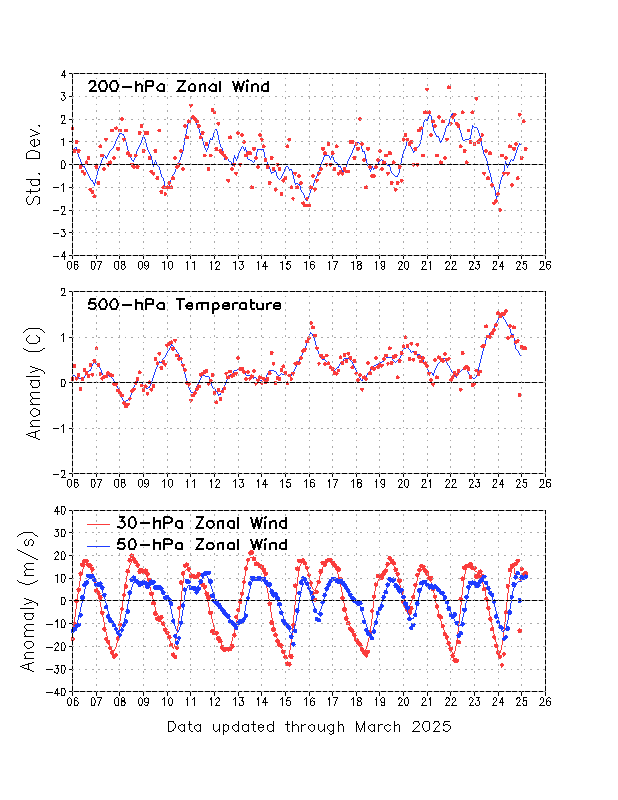
Theodor Landscheidt believed that ENSO events are correlated to solar subcycles which have enhanced x-ray flare activity. The Southern Oscillation Index (SOI) was used, because it changes before temperatures do. Significantly anomalous values in the SOI go back to August of 2014. It was only in July 2015 that the SOI indicated a strong El Nino, but trade winds were weaker than normal (westerly anomalies, shown in red below) for many months before that:
X-ray flares did increase in August 2014 right when SOI indicated the beginnings of El Nino:
Don Easterbrook has noticed that El Ninos correlate to spikes in the AP index (indicates geomagnetic activity). In March, the AP index reached the highest value since September 2005:

Jul 14, 2015

Boone County Supercell July 13

Yesterday, this storm in Boone County, IL damaged trees and power lines, and produced golf ball size hail near Poplar Grove, IL:


There was also a weaker cell to its south:


And this one to its southwest:

We were driving north on I-39 just north of US 34 at the beginning of the video below. At that time the storm was probably 50 miles away. The video runs from 8:46 - 9:12 PM CDT as we go through LaSalle, Lee and Ogle counties.

Here is the storm from up close. We are driving east on 173 between I-39 and 76 from 9:37-9:41 PM CDT.

Jun 21, 2015

June 20 2015 Storm Chase

Yesterday (June 20th), we were storm chasing eastern in Iowa. We saw a very well defined shelf cloud associated with a severe squall line which had horizontal rotation at Wayland, IA. This was from 7:00-7:05 PM CDT:

6 minutes later, and a little east of Wayland on highway 78:
A view from directly underneath the shelf cloud at the junction of 78 and US 218 at 7:14 PM:

While we were on our way home after the storm chase, we encountered a spectacular sunset near Muscatine, IA. We were able to see lightning from the storm to our east, a rainbow, crepuscular rays, and even anti-crepuscular rays. This was from 8:19-8:34 PM CDT.