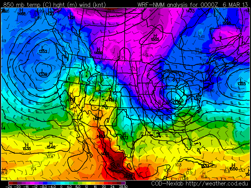
On April 3rd, a narrow band of cold air allowed accumulating snow to fall in central Oklahoma:
On April 9th, a storm ran warm 12C air at 850 mb over cold surface air with temps near freezing:
As a result, a convective squall line moving through central Kansas produced winter conditions at ground level. At 9:00 PM CDT, Concordia was under a severe thunderstorm warning while reporting freezing rain, a temperature of 30, a north wind at 24 mph, gusting to 35, and a wind chill of 16. Salina reported light snow, fog, a temperature of 33, wind northwest at 32, gusting to 38, and a wind chill of 19. Hutchinson reported a thunderstorm with a temperature of 32, fog, wind north at 16 gusting to 36, and a wind chill of 21. Radar from 9:11 CDT:
By 10:00 PM CDT, Hutchinson was reporting hail with a temperature of 32, fog, a north wind at 26 mph gusting to 37, and a wind chill of 18. Radar from 9:54 CDT:
Roads were
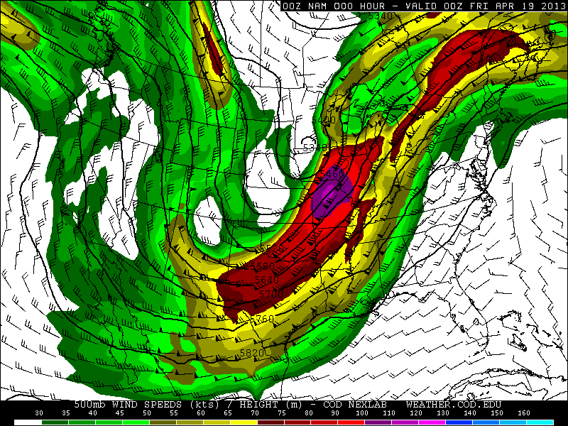
coated with ice as far south as the Oklahoma-Texas border. Snowfall amounts from this storm include 28.5" at Lander, WY; 24" at Harrison, NE; 30.0" at Deadwood, SD; and a record shattering 28.2" at Rapid City, SD. The previous record from a single storm in Rapid City was 18.0" on April 22, 2001. Some wind gusts from the storm in mph are: 84 at Castaic Lake, CA; 78 at Dubuque, IA; 85 at Menominee, MI.
From April 16-19 this storm produced heavy snow from Colorado to Michigan:
Snowfall amounts: 20.0" at Great Basin National Park, NV; 9.5" at Denver, CO; 23.4" at Fort Collins, CO; 33.0" at Virginia Dale, CO; 36.0" at Centennial, WY; 17.3" at Cheyenne, WY; 17.7" at Duluth, MN; 8.1" at Minneapolis, MN; 22.0" at Cornucopia, WI. This storm also produced huge amounts of rain including 8.20" at Pella, IA and 7.34" at Naperville, IL.
Just a few days later, another surge of cold air allowed for snow to fall in Oklahoma and significant accumulations to occur across I-70 in Kansas:
For the morning of April 24th, a freeze warning was issued for Lubbock, TX, and a hard freeze warning for Amarillo, TX:
On April 25th, frost advisories were issued from extreme northern Texas to Tennessee:
On April 24th, low temperatures were 25 at Lubbock, and 20 at Amarillo. On the 25th, Nashville had a low of 36.
On April 26th, Fargo, ND had the latest 50 degree day on record, with the previous record being April 17th in 1881. April was the snowiest month of the 2012-2013 winter season in Fargo.
As of April 26th, the United States had the
second coldest start to a spring on record.
On May 1st and 2nd, 850 temps as cold as -4C were reaching Texas:
By May 3rd, a freeze warning was issued for San Angelo, TX, and a winter weather advisory was active for northwest Arkansas:
Accumulating snow fell as far south as northeast Oklahoma and northwest Arkansas:
Up to 5" of snow fell in Arkansas. This is the
first time snow has been recorded in Arkansas in the month of May. At Tulsa, OK, snow fell on May 2nd, breaking the previous latest snow on record of April 18th in 1953. Records in Tulsa go back to 1900.
Another surge of cold air prompted a frost advisory for Nashville on May 13th:
Record lows of 39 at Nashville and 33 at Crossville occurred on May 13th.
On May 14th, a blizzard
hit the UK with 65 mph wind and power outages.