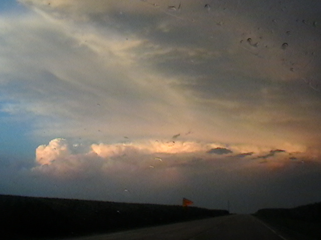
Yesterday, this storm in Boone County, IL damaged trees and power lines, and produced golf ball size hail near Poplar Grove, IL:
There was also a weaker cell to its south:
And this one to its southwest:
We were driving north on I-39 just north of US 34 at the beginning of the video below. At that time the storm was probably 50 miles away. The video runs from 8:46 - 9:12 PM CDT as we go through LaSalle, Lee and Ogle counties.
Here is the storm from up close. We are driving east on 173 between I-39 and 76 from 9:37-9:41 PM CDT.
Yesterday (June 20th), we were storm chasing eastern in Iowa. We saw a very well defined shelf cloud associated with a severe squall line which had horizontal rotation at Wayland, IA. This was from 7:00-7:05 PM CDT:
6 minutes later, and a little east of Wayland on highway 78:
A view from directly underneath the shelf cloud at the junction of 78 and US 218 at 7:14 PM:
While we were on our way home after the storm chase, we encountered a spectacular sunset near Muscatine, IA. We were able to see lightning from the storm to our east, a rainbow, crepuscular rays, and even anti-crepuscular rays. This was from 8:19-8:34 PM CDT.
On May 8th and 9th, a mid-level jet streak emerged into the Central Plains, triggering severe weather. Here are the storms that we saw. On Friday, May 8th, we tracked a supercell along the Red River Valley. We first intercepted it at the junction of US 183 and 287 east of Vernon, TX. This video is from while we are driving east on 287 near Harold, TX from 4:50-4:58 PM CDT:
This one is while we are driving north on 1739 and then east on 240 from 5:16-5:19 PM CDT:
We followed it into far southern Oklahoma, heading east on US 70. This is from just east of Randlett from 5:50-5:53 PM CDT.
The view from the junction of US 70 and 65 was had low contrast, but there was starting to be some good lightning. This was from 6:14-6:18 PM CDT:
From 6:31-6:41 PM CDT the structure had become impressive, there was more intense lightning, and the storm was producing a constant low rumbling sound. We are on US 70 west of Waurika and south of Hastings.
One more good view from Waurika, at the intersection of US 70 and US 81 from 6:54-6:59 PM CDT:
On May 9th, we caught a storm that had recently developed in the Texas Panhandle along a dry line, and moved into the Oklahoma Panhandle. We are on US 64 about 5 miles northeast of Beaver, east of Forgan, and east of highway 23. This is from 6:35-6:36 PM CDT on May 9, 2015:
These next three are from the same spot, at 6:45-6:46, 6:48, and 7:01-7:03 PM CDT:
This one is from a little further east on US 64 from 7:15-7:17 PM CDT:
The next video is from Kansas highway 34, north of US 160, northeast of Ashland, and west of Coldwater. This was from 8:26-8:27 PM CDT:
As we continued north on 34, the storm intensified. This was from 8:29-8:37 PM CDT, and towards the end of the video, we are nearing Bucklin and US 54:
At the beginning of the next video, we are at Bucklin, on Kansas highway 34, just south of US 54 seeing excellent storm structure. We then drive east on 54, then north from Mullinville. This was from 8:38-8:58 PM CDT:
The same synoptic scale system responsible for these storms also produced blizzard conditions in western South Dakota.
Today is the 8th anniversary of the F-5 Greensburg tornado. The Greensburg tornado developed at night, so it was only visible when illuminated by lightning. So, I made a video showing just the frames with best lightning illumination. All of the frames that reveal the tornado were taken from highway 183 south of Greensburg, looking west at first, then later looking north. The tornado began to hit Greensburg at 2:10. The final one is from highway 160, looking at the storm to our northeast, over 100 miles away, and with lightning shooting out the top.
A tornado outbreak occurred across eastern Iowa and Northern Illinois today, April 9. Here is what we saw. A funnel cloud formed to our north as we drove west on I-80 from the junction with 280 near Davenport, Iowa. The video ends at 5:15 PM CDT and two minutes later, a tornado was reported to the northeast near Donahue:
An intense supercell produced a tornado that caused damage at Ashton, Rochelle, Fairdale, and Kirkland in Lee, Ogle, and De Kalb counties in Illinois. We got our first good look at this storm when it was near Rochelle, while we were to the the southwest on I-88 near Ashton. This video runs from 7:02-7:04 PM CDT on April 9, 2015:
It became more clear how intense this storm was as we approached Rochelle, as spectacular lightning became very frequent. We are at the junction of I-88 and Illinois 251 at the beginning of the video, and near the junction of I-39 and Illinois 72 by the end. The video runs from 7:08-7:23 PM CDT on April 9, 2015:
Thursday, April 9 is the 4th anniversary of the EF-3 Mapleton, IA tornado. I have video from Onawa, IA from 6:43 - 6:56 PM CDT - about 40 minutes before Mapleton was hit - of what may have been the beginnings of the Mapleton tornado:
From just east of Onawa, on highway 175, from 7:00 - 7:03 we saw a circulation cross the road to our west:
I have plenty of video from this storm, and we only saw the tornado after dark, so I made a slideshow to show how it all evolved:
I am a self taught meteorologist and storm chaser. Much of my original interest came from Joe D'Aleo. I was later interested in the work of Theodor Landscheidt. My views on politics and economics are very close to those of Walter E Williams.