Aug 31, 2012

Hurricane Isaac

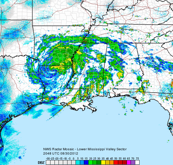
A radar and satellite history of Hurricane Isaac:


Isaac reached peak strength as it approached the Gulf Coast on August 28th with a minimum pressure of 968 mb, and winds at 80 mph. Wind gusted to 74 mph in New Orleans, and 78 mph at Boothville (on the Mississippi River Delta). Isaac knocked out power to over 900,000 customers in Louisiana, 150,000 in Mississippi, and brought 17.04" of rain to a CoCoRaHS station near Kiln, MS.

This is Hurricane Kirk in the central Atlantic with winds of 100 mph:

Aug 1, 2012

New Link Added

This sounds crazy, but maybe it's not:

http://www.buildtheenterprise.org/

The first step should be to demonstrate that something like this really is technologically possible, and not too costly.

Derecho and Heat Wave

On June 29th, a derecho swept from Illinois to the Mid Atlantic coast, causing widespread damage over a huge area:
22 people were killed, and power outages totaled over 4 million. A sounding from Wilmington, OH taken at 2:00 PM just ahead of the storms indicated that surface based CAPE was 6383 J/kg, and the lifted index was -15. RUC analysis continued to indicate 6000 CAPE ahead of the main line at 0Z, and a strong west-northwest mid level flow just behind it:


Temperatures ahead of the derecho were as high as 102, with dewpoint depressions well over 30F:
A major heat wave was affecting most of the central and eastern US throughout late June and early July. On Independence Day, excessive heat warnings (violet) were active from Omaha to Detroit:

Jul 27, 2012

More Strange Named Storms

Can you find the tropical storm in here?
The small cluster of convection just southeast of South Carolina was named Tropical Storm Alberto at 21Z on May 19th. RUC analysis indicates that Alberto was just downstream of an upper low and had a temperature at 850 mb of only 12C in the core.
How about this one?
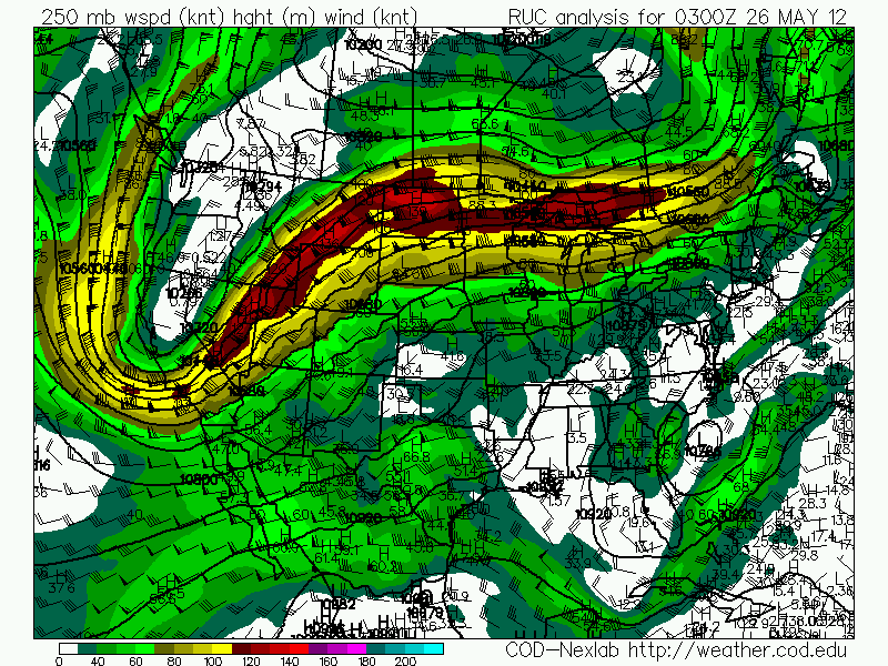
The area of convection just off the coast of The Carolinas was named Subtropical Storm Beryl at 3Z on the May 26th. It appears to be part of an extratropical system, with warm air advection occurring to its south and east. It does have a warm core, but it is still downstream from a broad upper low:

Beryl did later obtain tropical characteristics as it moved westward toward Florida.

At 3Z on June 19, the system south of Newfoundland was named Tropical Storm Chris:
It was at 39.3 latitude at the time it was named. Over the next two days, Chris took on an increasingly tropical appearance.
Sometime after the above satellite image, Chris formed an eye. It was named a hurricane on the 21st at 15Z.

It is not just a question of whether these marginal storms should be named, but also whether such storms would have been named in the past. For climatological purposes, it may be wise to completely ignore tropical storms, and look only at hurricanes. Or perhaps someone could attempt to determine which named storms need to be removed in order to have a consistent record.
Jul 14, 2012

Rice County Kansas Tornado

On April 3rd, a tornado outbreak hit the Dallas-Fort Worth area, causing an estimated $1 billion in damage.
On April 11th, freeze warnings (light blue) were issued in the Southeast, and frost advisories (blue) went down to Macon, GA:
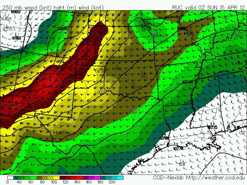
 On April 14th, a huge tornado outbreak hit the Central  Plains:
A 987 mb low was over eastern Colorado:
Over the warm sector in central Kansas, surface winds were southeasterly, 850 mb winds were south at 50 knots, 700 mb southwest around 45, and 500 mb southwest at 75:


RUC analyzed helicity mostly in the 400-500 range.

 The second image is 0-1 km. The soundings from Dodge City and Topeka both show helicity over 600:

Radar imagery from a supercell in central Kansas around 2250Z (5:50 CDT) while it has an EF4 tornado on the ground near the Rice-Ellsworth County line:

I was out chasing that day and was able to get some good video of the tornado that that cell was producing at the exact time of the above radar images.

Immediately after this video, the tornado does this to a house 1 mile southwest of the intersection of Highways 4 and 141:
This is where the EF4 rating comes from.

We later saw another tornado just east of Salina produced by the same cell:
On April 22nd, a Nor'easter prompted winter storm warnings (pink) from New York to West Virginia:

Laurel Summit, PA had 23.7" of snow. In New York and Pennsylvania 75,000 customers lost power. RUC analysis charts show just how large this storm was.

Notice the 500 mb 100 knot speed max over the Gulf Coast.