An overview of how I do forecasting before a storm chase.
A Source of Lift
Usually, thunderstorms won't initiate without some type of lift. Lift is usually produced by jet stream dynamics, surface boundaries, and sometimes topography (orographic lift). When the flow aloft is diffluent, it tends to produce lift underneath it. Frontal boundaries, drylines and outflow boundaries are sources of lift as airmasses with different densities converge. Lift can also be produced by upslope flow.
Convective Available Potential Energy (CAPE)
A measure of instability. When air near the Earth's surface is lifted, it expands and cools. Eventually condensation can occur, which releases latent heat and further increases buoyancy. This is what drives thunderstorm development. CAPE measures how much buoyancy is available. Usually I'm looking for CAPE of least 1,000 J/KG.
Convective Inhibition (CINH)
Convective Inhibition measures how much warm air aloft is inhibiting thunderstorm initiation (negative buoyancy). Usually this needs to be less than 50 J/KG to allow thunderstorms to initiate, but it varies depending on the strength of the lifting.
Deep Layer Shear
In order to sustain thunderstorm updrafts, precipitation needs to moved away from the updraft by sufficient vertical wind shear (change in wind speed or direction with height). Usually I look at the effective bulk wind difference (EBWD). It should be 25 knots at a minimum, and preferably higher than 40 knots.
Low Level Shear
Shear in the lowest 1 KM is important for tornado formation. 0-1 KM storm relative helicity (SRH) should be at least 100 M2/S2, and preferably higher then 200 M2/S2.
Veering With Height
Discrete supercells are the most favorable storm mode for tornadoes. Supercells are more favored when the wind veers with height (turns clockwise). Ideally, winds at the surface will be from the east, and as you go up from the south, then from the west.
Lifted Condensation Level (LCL)
The lifted condensation level determines the height of the cloud base. When rain falls below the cloud base, evaporative cooling occurs. If the cloud base is too high, storms tend to produce too much cold outflow for tornadoes to form. Generally, I want LCL heights to be below 1.5 KM.
Storm Motion Vectors
Discrete supercells are most likely when the storm motion takes it away from the boundary that initiated the convection. If storms are moving parallel to a boundary, they tend to merge into a line. If storm motion is perpendicular to the boundary, supercells will be favored. Storms should also be moving faster than the boundary or they may be forced into a line or even be undercut by the boundary. For storm chasing purposes, a storm motion to the east if preferred because it is more aligned with the road network. Slower moving storms are also preferred. It can be difficult to keep up with a storm moving to the northeast at 40+ mph if the roads are all east-west and north-south.
Showing posts with label storm chasing. Show all posts
Showing posts with label storm chasing. Show all posts
Mar 13, 2022
Tornado Forecasting


May 3, 2017
Full Unedited Video of Greensburg Tornado
Tomorrow is the ten year anniversary of the F5 Greensburg tornado. On the night of May 4, 2007 a tornado grew to a width of 1.7 miles and destroyed most of Greensburg, KS, where 11 people were killed. It was the first F5 in 8 years.
Apr 20, 2017
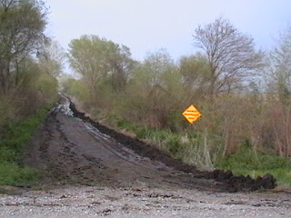
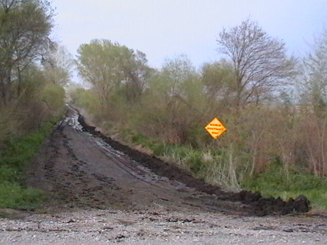
Minimum Maintenance Road
Yesterday when we were storm chasing in southeastern Nebraska, we came across a "minimum maintenance road". We decided to take a different route.
Jul 14, 2015
Boone County Supercell July 13
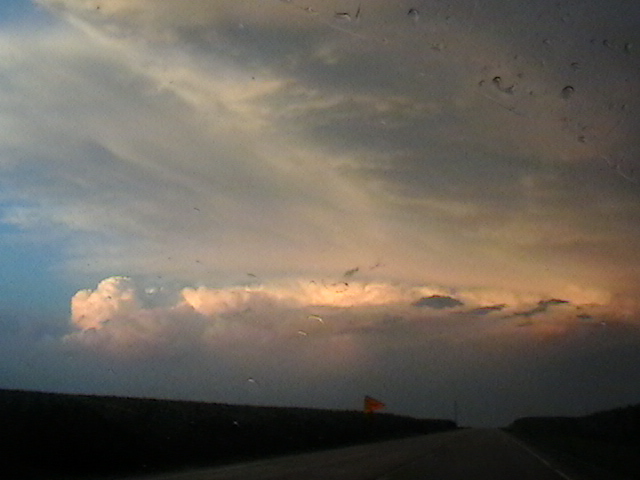
Yesterday, this storm in Boone County, IL damaged trees and power lines, and produced golf ball size hail near Poplar Grove, IL:


 There was also a weaker cell to its south:


And this one to its southwest:

 We were driving north on I-39 just north of US 34 at the beginning of the video below. At that time the storm was probably 50 miles away. The video runs from 8:46 - 9:12 PM CDT as we go through LaSalle, Lee and Ogle counties.
Here is the storm from up close. We are driving east on 173 between I-39 and 76 from 9:37-9:41 PM CDT.


And this one to its southwest:


Jun 21, 2015
June 20 2015 Storm Chase
Yesterday (June 20th), we were storm chasing eastern in Iowa. We saw a very well defined shelf cloud associated with a severe squall line which had horizontal rotation at Wayland, IA. This was from 7:00-7:05 PM CDT:
6 minutes later, and a little east of Wayland on highway 78:
A view from directly underneath the shelf cloud at the junction of 78 and US 218 at 7:14 PM:
While we were on our way home after the storm chase, we encountered a spectacular sunset near Muscatine, IA. We were able to see lightning from the storm to our east, a rainbow, crepuscular rays, and even anti-crepuscular rays. This was from 8:19-8:34 PM CDT.
6 minutes later, and a little east of Wayland on highway 78:
While we were on our way home after the storm chase, we encountered a spectacular sunset near Muscatine, IA. We were able to see lightning from the storm to our east, a rainbow, crepuscular rays, and even anti-crepuscular rays. This was from 8:19-8:34 PM CDT.
May 11, 2015
Storm Chasing May 8 and 9


May 4, 2015
Greensburg Tornado Anniversary
Today is the 8th anniversary of the F-5 Greensburg tornado. The Greensburg tornado developed at night, so it was only visible when illuminated by lightning. So, I made a video showing just the frames with best lightning illumination. All of the frames that reveal the tornado were taken from highway 183 south of Greensburg, looking west at first, then later looking north. The tornado began to hit Greensburg at 2:10. The final one is from highway 160, looking at the storm to our northeast, over 100 miles away, and with lightning shooting out the top.
Apr 10, 2015
Northern Illinois Tornadoes

Apr 6, 2015
Mapleton Tornado
Thursday, April 9 is the 4th anniversary of the EF-3 Mapleton, IA tornado. I have video from Onawa, IA from 6:43 - 6:56 PM CDT - about 40 minutes before Mapleton was hit - of what may have been the beginnings of the Mapleton tornado:
From just east of Onawa, on highway 175, from 7:00 - 7:03 we saw a circulation cross the road to our west:
I have plenty of video from this storm, and we only saw the tornado after dark, so I made a slideshow to show how it all evolved:
Sep 8, 2014
Storm Chasing Videos
All my storm chasing videos are organized chronologically here. A link has also been added in the sidebar to the right under "Links".
Aug 28, 2014
Storm Chases From 2010
On June 7th, 2010 at 7:22 MDT, a storm over Scottsbluff, NE began to rotate. We were so close, and the area of rotation so large, that it was difficult to fit it into the field of view:
Just two minutes later, a tornado touches down in Scottsbluff. Although the tornado is very difficult to see, several power flashes are visible. The tornado was rated EF-1. This video runs from 7:23-7:24 MDT:
40 minutes later, as we tracked the storm to Bridgeport, NE, it becomes the darkest storm I've ever seen. This is from 8:01-8:05 PM MDT, and sunset was at 8:25:
The next day, instead of storm chasing, we took a trip through Rocky Mountain National Park. A pileus cloud is seen at 6:20:
On June 11, we saw a storm with vertical (anticyclonic) and horizontal rotation 15 miles north of Strasburg, CO. We are on Headlight Road north of 112th Ave. This is from 4:57-4:59 MDT:
On July 22nd, we saw an intense storm with a well defined shelf cloud approaching Gorney Park in Caledonia, WI. This is from 8:01-8:04 PM CDT:
Just two minutes later, a tornado touches down in Scottsbluff. Although the tornado is very difficult to see, several power flashes are visible. The tornado was rated EF-1. This video runs from 7:23-7:24 MDT:
Jun 17, 2014
Stanton and Pilger NE Storm
Yesterday, we tracked the storm that hit Stanton and Pilger, NE with a strong tornado, from Pender, NE to Sioux City, IA.
There were multiple funnel clouds seen from 1 mile east of Pender on Route 94. This video is from 4:55-5:01 PM CDT on June 16, 2014:
There was good storm stucture a few miles north of Pender, NE on Route 9. This video runs from 5:10-5:12 CDT:
We saw two funnel clouds simultaneously between Pender and Emerson, NE on Route 9. The video runs from 5:13-5:17 PM CDT:
We found ourselves too close to rapid rotation while driving east on Route 35 just northeast of Emerson, NE. The video runs from 5:26-5:28 PM CDT:
There were rapidly rotating funnel clouds just southwest of Hubbard, NE on Route 35. The video runs from 5:32-5:35 PM CDT:
We saw great striations on Route 35 between Hubbard and Dakota City, NE. The video runs from 5:41-5:42 PM CDT:
We saw incredible storm structure on Route 35 between Hubbard and Dakota City, NE. The video is at 5:43 PM CDT:
The supercell had rapid rotation on Route 35 between Hubbard and Dakota City, NE. The video runs from 5:45-5:47 PM CDT:
The tilted updraft was visible from US 75/77 just north of Dakota City, NE as the storm began to weaken. This is from 5:53-5:54 PM CDT:
There were multiple funnel clouds seen from 1 mile east of Pender on Route 94. This video is from 4:55-5:01 PM CDT on June 16, 2014:
May 15, 2014
Nebraska Tornadoes and Snow
The same storm which produced tornadoes in eastern Nebraska, also produced heavy snow in western Nebraska:


 5" of snow fell at Scottsbluff (2.7 WNW), 1" fell in northwest Kansas (Kanorado), and 43" fell in Wyoming (Encampment 19 WSW).
Here is a radar review from the Hastings and Omaha Radar sites. York received 7.07" of rain from these storms and from some earlier that day.
We followed the main supercell from south of York to slightly East of Omaha. Here is some of what we saw
A huge inflow band seen from Rd 4, 1 mile west of McCool, or 9 miles south of York, NE at 4:30 PM CDT:
There was flying debris with an intense RFD near Cordova. This was on Route 76A between Cordova, NE and Highway US 6 from 5:05-5:08 PM CDT. A funnel may be visible at 1:33.
It became a large high-precipitation supercell by the time it passed near Linlocln. This was shot from near Omaha along I-680 at 72nd street from 7:25-7:29 PM CDT:
Now we are on I-680 just west of where it joins I-80 in Iowa or 3 miles north of Neola, IA at 8:02 PM CDT:
Here is a radar review from the Hastings and Omaha Radar sites. York received 7.07" of rain from these storms and from some earlier that day.
We followed the main supercell from south of York to slightly East of Omaha. Here is some of what we saw
A huge inflow band seen from Rd 4, 1 mile west of McCool, or 9 miles south of York, NE at 4:30 PM CDT:
There was flying debris with an intense RFD near Cordova. This was on Route 76A between Cordova, NE and Highway US 6 from 5:05-5:08 PM CDT. A funnel may be visible at 1:33.
It became a large high-precipitation supercell by the time it passed near Linlocln. This was shot from near Omaha along I-680 at 72nd street from 7:25-7:29 PM CDT:
Now we are on I-680 just west of where it joins I-80 in Iowa or 3 miles north of Neola, IA at 8:02 PM CDT:
Apr 29, 2014
Mississippi Tornadoes April 28 2014
This is the storm that hit Tupelo, Mississippi with a tornado on April 28, 2014. The tornado is not clearly visible because it is behind trees. It may be visible in the video from 1:42-1:48. Power was out in Tupelo when we were there later that night. We were driving south on US 45, starting one mile north of US 78. The video runs from 2:43-2:49 PM CDT.
This is the storm that later hit the Columbus, Mississippi area with a tornado. We were driving north on US 45 just north of Macon. The video runs from 5:31-5:34 PM CDT on April 28, 2014.
Same storm a few minutes later while we were driving north on US 45. At Brooksville, we turn northwest on Alt 45. This video runs from 5:37-5:45 PM CDT.
Tracking the same storm driving north on US 45 (not Alt 45) just north of Brooksville, Mississippi. This video runs from 5:54-5:57 PM CDT.
In this video we see the tornado slightly to the right of the road near the end of the video. We are driving north on US 45 between Brooksville and Columbus. Video runs from 5:58-6:01 PM CDT.
The right side of the funnel is visible for only the first 5 seconds of this video. The rest is tornado damage as we continue north on US 45 between Brooksville and Columbus. Video runs from 6:01-6:05 PM CDT.
This is the storm that later hit the Columbus, Mississippi area with a tornado. We were driving north on US 45 just north of Macon. The video runs from 5:31-5:34 PM CDT on April 28, 2014.
Same storm a few minutes later while we were driving north on US 45. At Brooksville, we turn northwest on Alt 45. This video runs from 5:37-5:45 PM CDT.
Tracking the same storm driving north on US 45 (not Alt 45) just north of Brooksville, Mississippi. This video runs from 5:54-5:57 PM CDT.
In this video we see the tornado slightly to the right of the road near the end of the video. We are driving north on US 45 between Brooksville and Columbus. Video runs from 5:58-6:01 PM CDT.
The right side of the funnel is visible for only the first 5 seconds of this video. The rest is tornado damage as we continue north on US 45 between Brooksville and Columbus. Video runs from 6:01-6:05 PM CDT.
Mar 1, 2014
Dan's Photos of the Washington Tornado
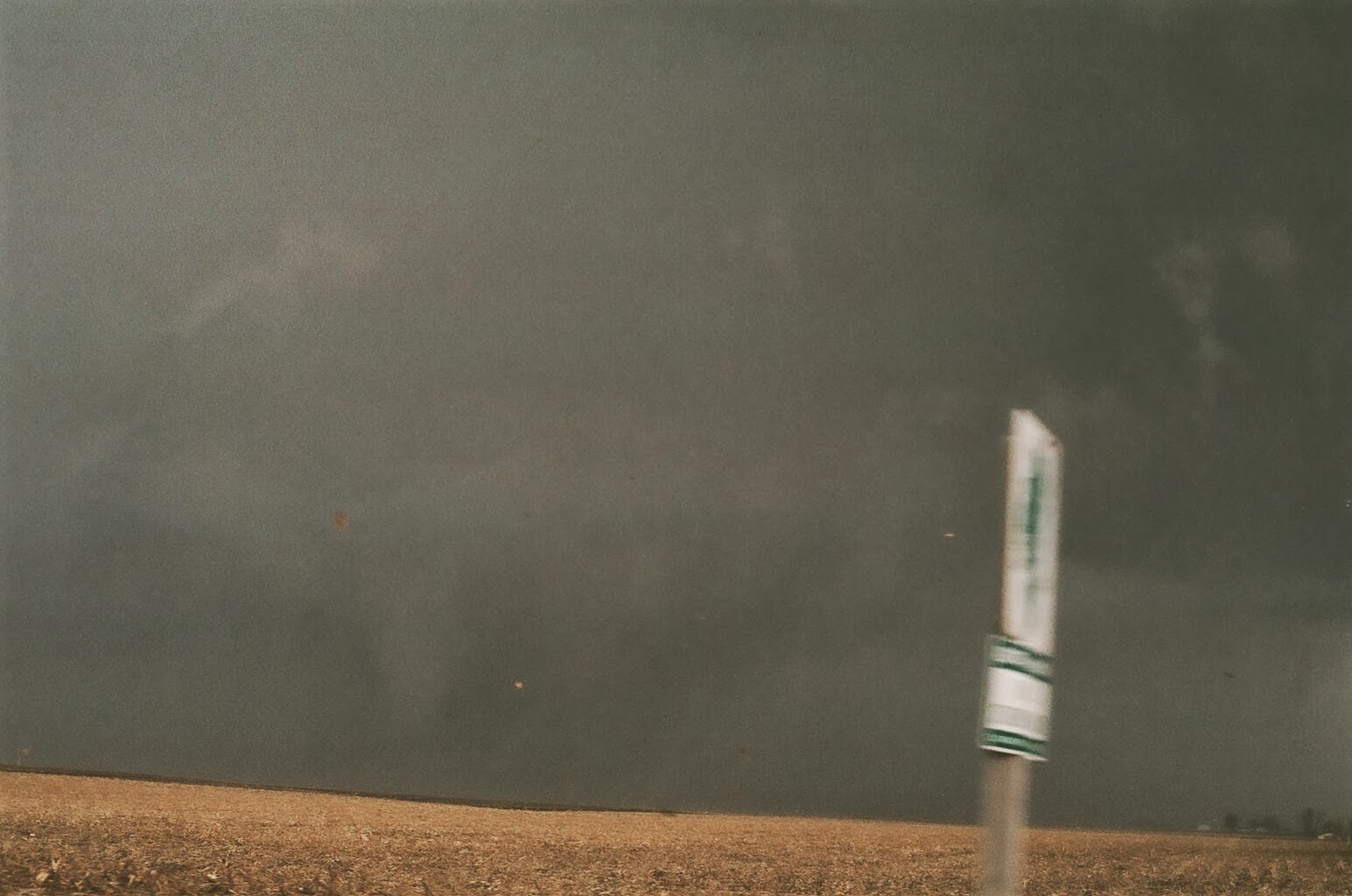
Dan's shots of the Washington tornado storm from near Benson, IL on Nov 17 2013:



Nov 18, 2013
Illinois Tornadoes November 17 2013
I managed to get some spectacular video of the EF-4 tornado that hit Washington, IL:
This video begins at 11:23 AM CST from 1 mile west of Benson, IL in Woodford County, at the junction of route 116 and 117. We are about 20 east-northeast of Peoria.
Damage along I-39:
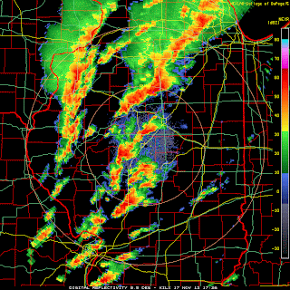
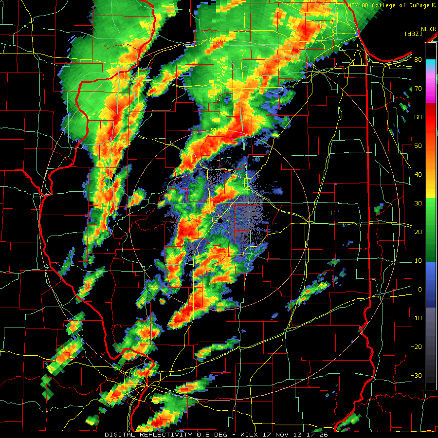
Radar imagery shows a classic hook and a 70+ knot rotational couplet (delta v probably around 150 knots):




This video begins at 11:23 AM CST from 1 mile west of Benson, IL in Woodford County, at the junction of route 116 and 117. We are about 20 east-northeast of Peoria.
Damage along I-39:
Radar imagery shows a classic hook and a 70+ knot rotational couplet (delta v probably around 150 knots):




This tornado formed in an area with 1,000-1,500 CAPE, 400-500 helicity, 62-64 dew points, 50+ knot low level jet, and an impressive 500 mb left exit region. The tornado developed at 1705Z and passed about 1/3 of the way from Lincoln (sounding at 16Z) to Davenport (sounding at 14Z):


Storm reports from the 17th:

The NHC has named a storm in the Central Atlantic Melissa, but it does not appear to be tropical in nature. It is on the lower right.


Jul 10, 2013
Lightning Video
A review of some of the most intense lightning video that I have going back to 2000.
0-1:10 Northern Missouri in May 2000.
1:10-1:22 The F-5 Greensburg storm on May 4, 2007.
1:22-1:47 Lightning out the top of the Greensburg storm seen from over 100 miles away.
1:47-3:58 Just south of Corning, KS on June 5, 2008.
3:58-6:45 Texas Panhandle between Borger and Perryton on June 12, 2010.
0-1:10 Northern Missouri in May 2000.
1:10-1:22 The F-5 Greensburg storm on May 4, 2007.
1:22-1:47 Lightning out the top of the Greensburg storm seen from over 100 miles away.
1:47-3:58 Just south of Corning, KS on June 5, 2008.
3:58-6:45 Texas Panhandle between Borger and Perryton on June 12, 2010.
Jun 3, 2013
May Tornadoes
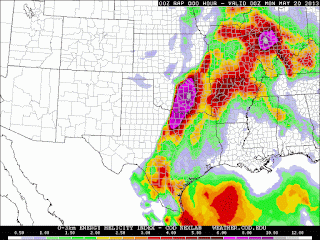
On May 15th, 18 tornadoes touched down across the Dallas-Fort Worth metro including an EF-4 which struck Granbury, killing 6 and injuring dozens. The 500 mb chart for this event was not very impressive with a speed maximum of only 30 knots. However, the southwesterly 30 knot flow at 850 mb combined with surface winds backed to southeasterly produced storm relative helicities (SRH) of 450 0-3 km and 200+ 0-1 km:



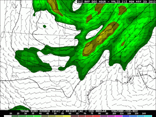
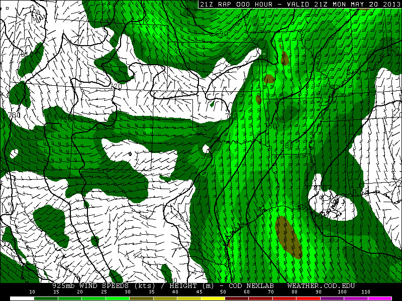
 The next day, May 20th, another mid-level speed max ejected into the Southern Plains and produced the 1.3 mile wide EF-5 Moore tornado which killed 24, injured 377, and damaged or destroyed over 12,000 homes. A radar loop showing debris ball and intense rotational couplet is here and a radar timeline here. See incredible video here, here, here, here, initial touchdown here, and helicopter time lapse here. What surprised me about the Moore tornado is that although the 500 mb speed was 60 knots, and the 700 mb speed was 45 knots, 850 winds were only 25 knots, producing 0-3 km and 0-1 SRH values of just 300 and 150 respectively. Similar to the Shawnee tornado, surface winds were backed only very locally near Oklahoma City, producing a very small bullseye in the significant tornado parameter:



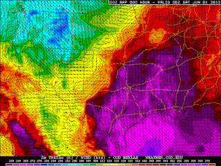


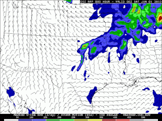


 I have a number of storm chasing videos on my Youtube channel from last month. This one is probably the most interesting:


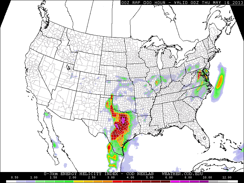


On May 19th, 6 tornadoes occurred in central Oklahoma including the EF-4 Shawnee tornado which killed 2. A radar loop is here. Video here and here. A tornado near Clearwater, Kansas was given an EF-2 rating based on radar data from the Doppler on Wheels. The Shawnee tornado was no surprise given a 60 knot southwesterly 500 mb jet, 35-40 knot southerly 850 low-level jet, and locally backed winds near Oklahoma City producing a 0-3 km SRH of 450 and 0-1 km SRH of 300. Note the small bullseye of 10 (top of the scale) in the significant tornado parameter (last chart below) over Oklahoma City.


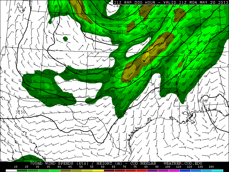



Preliminary damage path for the Moore tornado:

On May 31st, EF-3 tornadoes developed at El Reno, OK and the St. Louis metro. The El Reno tornado killed 13, and hit several storm chase teams, including Tim Samaras, Paul Samaras and Carl Young, all of whom were killed. Video of amazing multiple vortex structure here, and here. See the Weather Channel's Mike Bettes being hit by the tornado here, and here, and other chasers being hit here, and here. Radar loops and photos of the El Reno tornado here. For the El Reno tornado, RAP analysis indicates 500 mb winds west-southwest at 50 knots, 700 mb winds southwest at 40 knots, 850 winds south at 30 knots, and southeast surface winds producing, SRH around 300 0-3km and 150 0-1 km. The Oklahoma City radiosonde observation shows a slightly stronger and much more veered flow immediately above 850 mb, and a 0-3 km SRH of 476:


Some have speculated that these tornadoes may be linked to global warming. Is is too easy to forget that the 12-month period before the May spike in tornadoes was at a record low:

If deadly tornadoes are evidence of global warming, what does a record quiet period indicate?
Subscribe to:
Posts (Atom)