This video begins at 11:23 AM CST from 1 mile west of Benson, IL in Woodford County, at the junction of route 116 and 117. We are about 20 east-northeast of Peoria.
Damage along I-39:
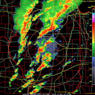
Radar imagery shows a classic hook and a 70+ knot rotational couplet (delta v probably around 150 knots):
This tornado formed in an area with 1,000-1,500 CAPE, 400-500 helicity, 62-64 dew points, 50+ knot low level jet, and an impressive 500 mb left exit region. The tornado developed at 1705Z and passed about 1/3 of the way from Lincoln (sounding at 16Z) to Davenport (sounding at 14Z):
Storm reports from the 17th:
The NHC has named a storm in the Central Atlantic Melissa, but it does not appear to be tropical in nature. It is on the lower right.


No comments:
Post a Comment