Jan 25, 2014

Historic Groundhog Day Blizzard of 2011

As we approach the third anniversary of the historic Groundhog Day blizzard of 2011, I thought I would review my experience with it. The official snow total for Chicago was 21.2". The first thing I noticed on the morning of February 2nd 2011 was that there was such a large snow drift covering the front door, that it would not open!

At the beginning of the next video, you see can that snow had been forced underneath the door and into the house before I even opened the door.

I forced the front door open and looked around outside...

The snow drifted into an interesting pattern around a large tree in the backyard. Snow can be seen blowing off the roof at 0:32.

This was recorded on the afternoon of February 2nd. Although some shoveling had been done now, it would still take a long time before the van would be dug out. A substantial part of the pine tree seen at 0:33 was later taken down.

The top of the pine tree that was knocked down:


Jan 24, 2014

Houston Winter Storm

A winter storm hit Houston with sleet and freezing rain last night and this morning (Jan 23-24). Galveston received freezing rain. I-10 was closed at the Texas-Louisiana border.

Jan 22, 2014

Winter Update

This storm produced 7" of snow at Washington DC (National Zoo), 11.5" at Central Park, New York, 15.8" in New Jersey (Manalapan), and 18.3" in Massachusetts (Norwell):
4,400 flights were cancelled across the Northeast.

Houston is now under a winter storm watch; NAM shows rain changing to sleet tomorrow night, and GFS shows sleet and freezing rain.
A large part of the Central US is under wind chill advisories, and much of Florida is under a freeze warning as another piece of arctic air is on the way:
If the latest ECMWF holds, Florida may be even colder next week:

Jan 15, 2014

Washington Tornado Radar HD

A radar review of the Washington, IL tornado outbreak from November 17th, 2013:

Jan 13, 2014

Another North Atlantic Storm

Yesterday, a storm approaching the British Isles dropped to 958 mb:
An eye is visible at the top of the second water vapor image (from 18z):


Jan 9, 2014

Arctic Outbreak Update

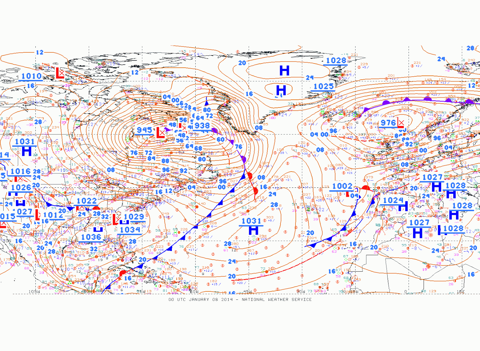
The storm which hit the Midwest and Northeast with heavy snow and extreme cold on January 4-7 became a 938 mb storm just off the coast of Labrador yesterday (Januarty 8th):
This storm hit Benton Harbor, MI with 27" of snow (much of it lake effect) and Chicago O'Hare with an air temperature of -16 and a windchill of -42. On January 7th, Atlanta had a record low of 6, and New Orleans had a low of 24.