An intense low pressure system has deepened to 958 mb (as of 1:00 PM CDT) over northeast Minnesota this morning. A blizzard warning (red) has been issued for most of North Dakota, high wind warnings (brown) stretch from the Dakotas to Ohio/Kentucky, and storm warnings are in effect for Lakes Superior, Michigan and Huron:

Note also that tornado warnings (slightly darker red) run from Michigan to Mississippi. Numerous supercells were embedded along the main squall line.

Tornado watches run from Michigan to Arkansas despite very weak instability.

CAPE was below 500 J/KG in most of these areas:

Wind speeds were over 70 knots at 850 mb, 80 knots at 700 mb, and 120 knots at 500 mb:


With wind speeds that high, even a slight veering relative to surface winds will produce very strong shear.

Helicity values exceeded 800 M2/S2 over Indiana:

 Note also that tornado warnings (slightly darker red) run from Michigan to Mississippi. Numerous supercells were embedded along the main squall line.
 Tornado watches run from Michigan to Arkansas despite very weak instability.
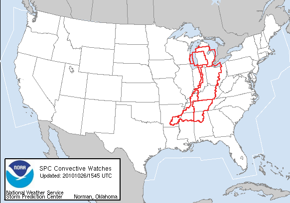 CAPE was below 500 J/KG in most of these areas:
 Wind speeds were over 70 knots at 850 mb, 80 knots at 700 mb, and 120 knots at 500 mb:

 With wind speeds that high, even a slight veering relative to surface winds will produce very strong shear.
 Helicity values exceeded 800 M2/S2 over Indiana:
No comments:
Post a Comment