Aug 31, 2012

Hurricane Isaac

A radar and satellite history of Hurricane Isaac:


Isaac reached peak strength as it approached the Gulf Coast on August 28th with a minimum pressure of 968 mb, and winds at 80 mph. Wind gusted to 74 mph in New Orleans, and 78 mph at Boothville (on the Mississippi River Delta). Isaac knocked out power to over 900,000 customers in Louisiana, 150,000 in Mississippi, and brought 17.04" of rain to a CoCoRaHS station near Kiln, MS.

This is Hurricane Kirk in the central Atlantic with winds of 100 mph:

Aug 1, 2012

New Link Added

This sounds crazy, but maybe it's not:

http://www.buildtheenterprise.org/

The first step should be to demonstrate that something like this really is technologically possible, and not too costly.

Derecho and Heat Wave

On June 29th, a derecho swept from Illinois to the Mid Atlantic coast, causing widespread damage over a huge area:
22 people were killed, and power outages totaled over 4 million. A sounding from Wilmington, OH taken at 2:00 PM just ahead of the storms indicated that surface based CAPE was 6383 J/kg, and the lifted index was -15. RUC analysis continued to indicate 6000 CAPE ahead of the main line at 0Z, and a strong west-northwest mid level flow just behind it:


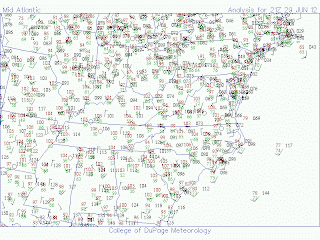
Temperatures ahead of the derecho were as high as 102, with dewpoint depressions well over 30F:
A major heat wave was affecting most of the central and eastern US throughout late June and early July. On Independence Day, excessive heat warnings (violet) were active from Omaha to Detroit: