On January 4th, record low temperatures were recorded in Florida:
Apalachicola 26
Alma 19
Gainesville 20
Jacksonville 22 (tied old record set in 1887)
Melbourne 33
Naples 36
On January 8th, winter storm warnings (pink) were issued for Midland Texas, and a winter weather advisory for Big Bend National Park:
This huge storm extended from the Caribbean to the Upper Midwset on January 12th:
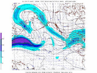
Also on January 12th, this Northwest Pacific jet stream produced a 944 mb low:
A few days later (the 15th), a 1059 mb high was analyzed on the Alaska-Yukon border.
It was associated with this upper ridge over the Bering Sea:
By January 17th, it was 1060 mb on the North Coast of Alaska:
The Great Lakes storm system seen in the chart above produced tornadoes across the Ohio and Lower Mississippi Valleys. Tornado warnings were being issued the previous night after midnight in Missouri:
This was occurring while the temperatures were in the lower 60s, the dew points were in the mid 50s, and it was snowing only about 250 miles away in Nebraska:
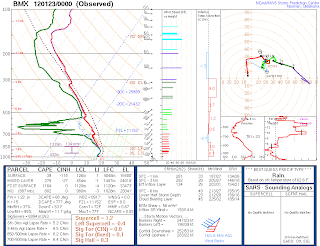
CAPE values in Missouri were only around 250 J/kg:
However, this was in a broad area of deep, strong southwesterly flow - 60 knots down to 850 mb - which produced impressive helicity values:
On January 18th, most of the Pacific Northwest was under a winter storm warning, and much of the Oregon Coast was under a storm warning (purple) or hurricane force wind warning (brown):
The dark blue over Minnesota and the Dakotas is an extreme cold warning.
Water vapor images from the 18th and 20th:
By the 20th, Oregon had been hit with over 4 feet of snow (Mt Hood Meadows), 15.5" of rain (Swiss Home), 1 inch of ice (N Parkdale), and 88 mph wind (Summer Lake). Pictures of the ice storm are here.
On January 22nd, this 994 mb low over Kansas produced another January tornado outbreak:
This system featured an intense mid-level trough, and 50+ knot southwesterly 850 mb winds placed over south to southeast surface winds, producing over 500 m2/s2 storm relative helicity, which was coincident with a part of the warm sector which had 1,500 CAPE:
The next morning, a tornado produced EF3 damage at Center Point, Alabama. Sounding from Little Rock and Birmingham:
On January 27th, a Northwest Pacific storm reached 952 mb near 45N latitude:
On January 28th, the temperature at Jim River, Alaska dropped to -79F, but then the station stopped reporting temperature. The all time record low for the United States is -80F.
Apr 26, 2012
Subscribe to:
Posts (Atom)


